Projects
Corine Land Cover Plus Dataset
The aim of this project was to contribute to the preparation of training data to produce the new Corine Land Cover Plus dataset. The data was collected through visual interpretation of point samples on the basis of orthophotos and VHR satellite imagery. Labelling was according to the CLC+ nomenclature.
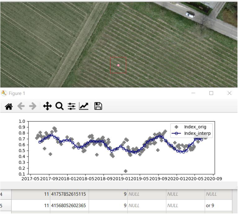
QGIS Customised Actions using Python
To support the CLC+ training data collection, NDVI profiles were provided in HDF format and visualization was only possible through Jupyter notebook. Hira developed Python scripts enabling the visualization of the NDVI profiles in QGIS. This allowed a more efficient interpretation.
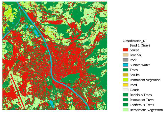
Land Use Land Cover Classification
Image classification was performed on Sentinel-2A data with variety of Machine Learning algorithms like Decision Tree, Random Forest, SVM and KNN.The classification quality was assessed using the Austrian Land Use and Land cover survey (LISA) as reference dataset
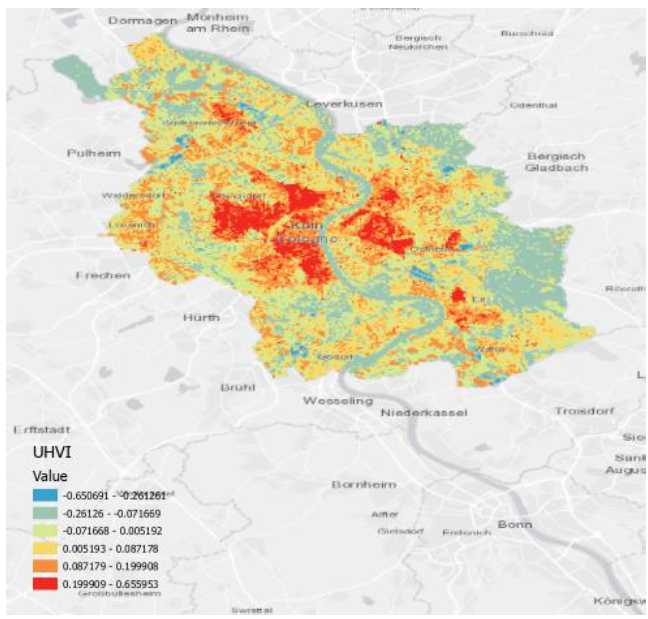
Urban Heat Vulnerability Index
The objective of this study was to find the urban heat vulnerability map for the city of cologne, Germany using Landsat 8. Vulnerability depends on exposure, sensitivity and adaptive capacity. This is done by quantitatively evaluating heat vulnerability with the help of these three components.
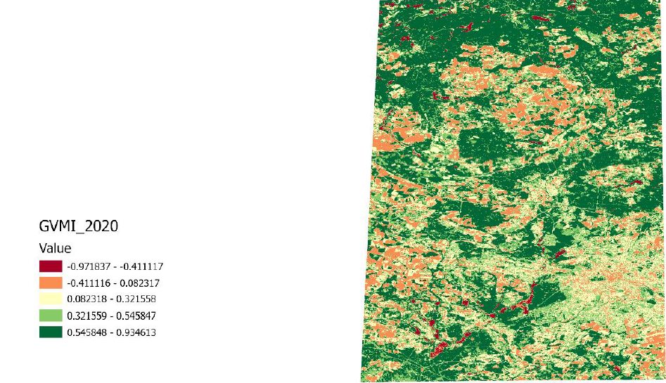
Drought Index Monitoring
Goal of this task was to calculate, visualize and compare different satellite data based drought indices.It was concluded tha Vegetation condition index and Global vegetation moisture index are important indicators for drought risk monitoring.